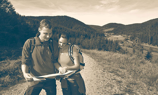
Hiking along the Danube
"Donauwellen" is a traditional German cake, but also the name of five certified hiking tours high above the Danube. Another hiking route lets you connect hiking and beer - the "Beer-Hiking" trail in Ehingen. In the Urdonau valley, you will find the "Ice Age" trails with a whole bunch of certified hiking trails. Do you want to hike for several days along the Danube in Bavaria? The "Urdonausteig" and the "Danube Panorama" route offer exactly that.
This is only a small selection of wonderful hiking trails in the Danube region. The local tourist information centres offer a lot more about the topic of hiking. So put your hiking boots on and go!
-

Alb trail (HW1)
Length: 357 km
Tuttlingen - Donauwörth
Immer an der Kante lang schlängelt sich der Albsteig, auch bekannt als HW1 oder Schwäbische Alb Nordrandweg, zwischen Donauwörth und Tuttlingen großteils auf naturbelassenen Pfaden am Albtrauf, der nördlichen Steilflanke der Schwäbischen Alb. Die Erlebnisroute passiert auf gut 350 ...
-
Bavarian-Swabian Jakobus trail
Length: 62 km
Oettingen - Allmannshofen
The Jokobus pilgrim trail in Bavarian-Swabia leads you from Oettingen over Wemding to Harburg at the eastern edge of the "Ries" crater. The section is characterized by varied cultural landscapes. From there, the route continues through the idyllic Wörnitz valley to Donauwörth and finally to ...
-

Bettelküchen path
Length: 10 km
Gutenstein (circular route)
Bei der »Bettelküchenfährte« handelt es sich um einen abwechslungsreichen Rundwanderweg. Die Tour verläuft meist durch lichten Mischwald und ist daher besonders an heißen Sommertagen zu empfehlen. Neben herrlichen Ausblicken ins Donautal bietet sich am Ende der Strecke ein Abstecher nach ...
-
Beer-Hiking trail
Length: 14 km
Ehingen (circular route)
For hiking-lovers in Ehingen, the slogan is "We hike from one beer to the next". The starting point of the route, which was voted as one of the 30 most beautiful hiking trails, is the market fountain in the heart of Ehingen. In the beginning, the trail leads you along the multimedia paths of the ...
-
biosphere tour contemplation trail
Length: 53 km
Ehingen (circular route)
The contemplation trail is still an insider tip. This is because of the 53 kilometres long biosphere route and the more the worth seeing surrounding theme routes in the idyllic towns Altsteußlingen, Granheim, Frankenhofen, Dächingen, Erbstetten and Mundingen. On all routes, your hike through ...
-
Blaubeurer rock trail
Length: 10 km
Ice Age trail
The beautiful start of the tour is the romantically located "Blautopf" (shimmering blue karst source). After the first ascent to the viewpoint "Blaufels", the path passes the "Knoblauchfels" and the former Rusencastle. After the crossing of the river Blau, the next stop is the "Brillen" cave, ...
-
Castle-Rock trail
Length: 7 km
Ice Age route
The wonderful Lauter valley is known in Germany as a valley full of castles. You can hike the most beautiful, 7 kilometres long, section on the "Castle-Rock" trail. Experience everything that has become very rare in the modern cultural landscape: A natural paradise in the UNESCO biosphere region ...
-
Danube-Panorama trail
Length: 220 km
Neustadt - Passau
Culture and nature are connected along the Danube-Panorama trail from Neustadt/Danube to Passau. From the beginning in the "hop region" Hallertau, the route leads along the Danube. During the hike, you will walk past the "Breakthrough of the Danube" in the nature reserve "Weltenburger Enge", the ...
-
Danube-Zollernalb trail
Length: 160 km
Gosheim - Beuron
The Danube-Zollernalb trail is an extension of the Donaubergland trail. It starts in Beuron and consists of three day tours, including the spectacular viewpoint "Eichfelsen" and the medieval Wildenstein castle in Leibertingen. After following the route left and right of the Danube, you will ...
-
Donaubergland trail
Length: 57 km
Gosheim - Beuron
From Lemberg to Beuron leads the first certified hiking trail of the Swabian Alb. Along the 60 kilometres of varied landscapes from the highest mountain of the Swabian Alb, over the Danube town of Mühlheim and Friedingen, to the famous Beuron monastery. During four comfortable day tours across ...
-

Donaufelsengarten
Length: 9 km
Gutenstein (circular route)
Wildromantisch durch das Gutenstein-Thiergarter Felsenlabyrinth verläuft der Premiumwanderweg »Donaufelsengarten«. Nach schweißtreibenden Anstiegen wird der Wanderer mit einem herrlichen Blick von den Felsen in das Donautal belohnt. Aber auch die dahinterliegende Albhochfläche hat einiges ...
-

Donauwelle Eichfelsen Panorama trail
Length: 12 km
Beuron (circular route)
DonauWellen-Tour rund ums Kloster Beuron mit den Premium-Aussichten auf die Donau und einem kräftigen Anstieg zu Beginn. Der Weg ist seit 6. Juli 2014 offiziell eröffnet. Alle andere DonauWellen-Touren finden Sie unter: www.donau-wellen.de
-

Ice Age Hunter path
Length: 9 km
Ice Age route
Die Höhlen im Achtal gelten als die Wiege der Kunst der Menschheit. Heute noch finden wir dort Spuren der Eiszeitmenschen und die erste figürliche Kunst überhaupt! Von der Brillenhöhle schlängelt sich der Rundweg durch das Felsenlabyrinth und vorbei an der Küssenden Sau zur Ruine ...
-

forest path Groppertal
Length: 11 km
Waldpfad (circular route)
Der Premiumweg führt auf überwiegend naturnahen Pfaden durch idyllische und abwechslungsreiche Waldpassagen, vorbei an vielen Baumriesen und mit herrlichen Aussichten auf das beschauliche Groppertal mit seinen typischen Schwarzwaldhöfen. Eine Vesperstube sowie der mitten im Wald gelegene ...
-

Goldsteig
Length: 21.5 km
Marktredwitz - Passau
Die Veste Oberhaus mit traumhaftem Blick auf die Passauer Altstadt ist Ausgangspunkt dieser Goldsteig-Etappe. Über die Ortsteile Zieglreut und Grubweg geht es rein ins Grüne in Richtung Granitstadt Hauzenberg. Teilweise verläuft der Goldsteig hier entlang der alten Bahnstrecke und vorbei an ...
-

Dutchess-Anna-Path
Length: 4 km
Hoechstaedt
Kleine Rundtour (4,1 km) durch den Auwald, entlang der Egau und des Schlosses Höchstädt Tauchen Sie ein in die Faszination Auwald und die Geschichte des Höchstädter Schlosses. Herzogin Anna von Pfalz-Neuburg ist auf dem 4 Kilometer langen Rundweg Ihre ständige Wegbegleiterin und informiert ...
-
Historic hiking trail
Length: 13 km
Donauwörth (circular route)
Der Wanderweg beginnt in der Innenstadt Donauwörths, auf der Altstadtinsel Ried, und führt vorbei an historischen Gebäuden der ehemals Freien Reichsstadt. Über die Promenade „die grüne Lunge“ der Stadt gelangen wir zum Kalvarienberg, erreichen den Schellenberg und schließlich auf den ...
-

Jura trail - Roman meander
Length: 14 km
Bad Gögging (circular route)
Auf den Spuren der Römer zwischen Abens und Donau Von Bad Gögging Wandern Se durch eine hübsche Weide- und Wiesenlandschaft. Über einen schwefelhaltigen Bach und an einer kleinen Kapelle vorbei geht es bald parallel zur Abens weiter. Für ca. 1,5 km führt der Weg am Hochwasserdamm entlang. ...
-
Jura trail - Stage 1
Length: 21 km
Kelheim - Bad Abbach
The first stage of the Jura trail starts in Kelheim at the Danube pier where the route leads through the old town. A small detour to the Hall of Liberation or the archaeological museum is perfect for the culture and history lovers. In the north of the city, the trail leads uphill to the Goldberg ...
-
Jura trail - Stage 2
Length: 16 km
Bad Abbach - Eilsbrunn
Before the Jura trail meets the conservation area "Oberndorfer Hänge", the route follows the idyllic Danube riverbank until the pedestrian bridge in the north of Bad Abbach. After an ascent through the town, the trail leads through a forest area with numerous nice views. In Matting, a cable ...
-

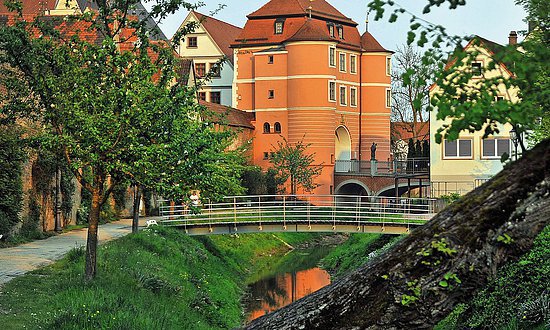
Monastery rocky path
Length: 13 km
Danube rocky paths
Auf dem Kloster-Felsenweg kommen nicht nur Wanderfreunde, sondern auch kulturell Interessierte auf ihre Kosten. Neben dem Kloster Inzigkofen mit seiner sehenswerten Barockkirche und dem liebevoll angelegten Kräutergarten gibt es im Inzigkofer Park zahlreiche Kleinode zu entdecken. Der ...
-

Lauterfelsen trail
Length: 14 km
Blaustein (circular route)
Mal kantig und aussichtsreich, mal lieblich und geschmeidig - eine Ausflug ins felsgeschmückte Kleine Lautertal und auf die Hochfläche der Alb ist ein Wandererlebnis. Bereits am Anstieg nach Oberherrlingen wird der Wanderer mit einem ersten Ausblick belohnt. Danach geht es bergab ins Lautertal ...
-

Paradise Tour Source Region
Length: 18 km
Donaueschingen (circular route)
Brigach und Breg bringen die Donau zuweg: Entlang ihrer beiden Quellflüsse verläuft diese landschaftlich und kulturell abwechslungsreiche Rundwanderung über die Baar ab Donaueschingen. Unterwegs kommen wir durch die malerischen Städtchen Hüfingen und Bräunlingen.
-
Pilgrim trail VIA NOVA (part)
Length: 19 km
Kelheim - Bad Abbach
The meander of the European pilgrim trail VIA NOVA, with its seven stages, leads through the district of Kelheim. During the hike, you will pass inter alia numerous former and active monasteries.
-

Premium Hiking Path Donauwald
Length: 59 km
Günzburg, Dillingen
„Grüner Streifzug an der Donau“ Auf rund 59 Kilometern erwandern Sie die außergewöhnliche Vielfalt des Auwaldes. Der Wechsel zwischen trockenen Magerrasen und den ehemaligen Flussschlingen der Donau hat seinen besonderen Reiz. Der Blick nach oben durch dicke alte Eichen und Laubwälder ...
-
Urdonau trail
Length: 63 km
Neuburg (circular route)
The Urdonau trail leads from Dollnstein in the southern nature park "Altmühltal" through the unique Wellheimer dry valley to the Danube. Five day tours present a distinctive landscape with smooth valley flanks, rough rock formations, original alluvial forests and of course the Danube. But also ...